Mapping Brooklyn Demolitions: It Ain't Pretty
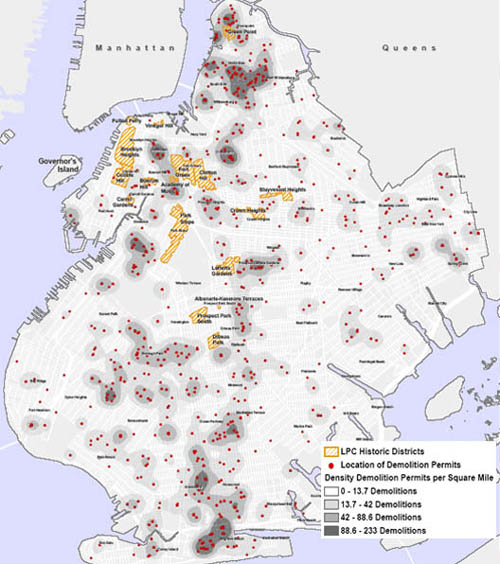
The good people at the Municipal Art Society have decided to tackle the subject of patterns in Brooklyn demolition permits and produced some maps that show where the wrecking ball is hard at work. An analysis by Lisa Kersavage concludes that there's a correlation between areas that have been upzoned and demolition activity. In fact, MAS argues that the maps show the need for the Landmarks Commission to act to protect neighborhoods before rezoning occurs so that significant buildings aren't lost (as has happened in Williamsburg and Greenpoint, for instance). Also, note the heavy concentration of demolition activity in and around Sheepshead Bay. There are actually several maps with Ms. Kersavage's article and all are worth a look.
posted by rsguskind at 8:20 AM
![]()
![]()

0 Comments:
Post a Comment
<< Home