Picking Up the Pieces at a Historic New York Relic
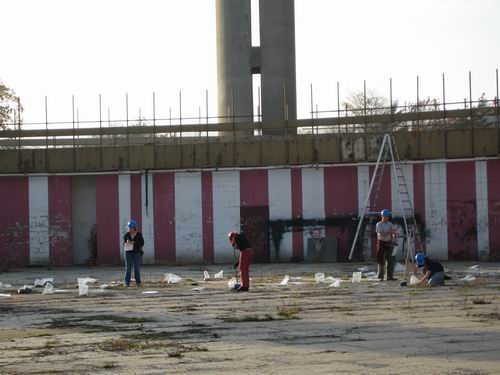
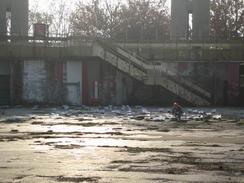
This weekend's article in the New York Times detailing the sad state of things at the old New York State Pavilion in Flushing Meadows Park reminded us that we hadn't been out to the park since the final day of the U.S. Open. So, we went for a stroll to shoot more photos and some video of Philip Johnson's building. We noticed the back gate was a bit open and found what looked like an archeological project underway inside. Actually, the people in the photo above, who were sweeping and picking up and bagging pieces of the floor are University of Pennyslvania students. They were mentioned in the Time article:
It might be hard to imagine now, but back then the pavilion’s central feature was a detailed, 9,000-square-foot map of New York State, made of 567 terrazzo mosaic panels laid across the rotunda’s floor. Billed as the largest map in the world, it allowed you to stroll from Montauk Point to that small place in Cattaraugus County — Ischua, wasn’t it? — where you had an aunt.And for those who really like their information detailed and written in optimistic World's Fair tones, here's a bit more from nywf64.com's page on the map:Soon after taking custody, the city turned this meticulous map into a roller rink. A few years later, city workers disassembled the glorious multicolored ceiling by hammering out the heavy panels, sending them crashing to the floor.
On and on the willful neglect continued, abetted by fiscal crises, until, finally, you could visit the ruined map and slip the I from Ischua into your pocket.
Graduate students from the University of Pennsylvania arenow collecting and cataloging the loose pieces of terrazzo and plastic, and are planning to restore some of the map for an exhibition next year. The thrust of the exhibition, presumably: This is what it looked like, way back then — in 1964.


ConstructedAnd now, they're sweeping it up and putting it in plastic bags.of 567 gleaming 16-foot squares, the mammoth map weighs 114 tons and is one of the most extensive terrazzo projects ever undertaken. According to Rand McNally and Company, it is the largest known representation of any 50,000 square mile area of the earth's surface...UPON DELIVERY at the New York State Pavilion, the 567 panels were placed on individual beds of sand and concrete reinforced with steel mesh. Special suction-cup lifts were used to move each 400-pound panel into its position in the huge mosaic. The scale of the map is so large that even local landmarks could be recognized if they were placed on it.

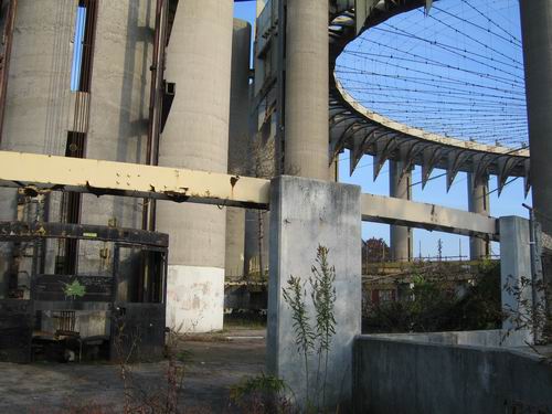
An ironic bit of trivia is that in the 1970s the map was supposed to have been removed and restored and installed at the World Trade Center complex. We'll have a vid of one of our favorite urban relics together soon. In the meantime, anyone interested in learning more about this building--what it was and what it has come to be through decades of official neglect--should check out this extensive set of pages at nwf64.com. There are also some cool photos and info over at Modern Ruins.
A couple more pics of the pavilion and the rescue effort below.
posted by rsguskind at 10:44 AM
![]()
![]()

1 Comments:
Wow, that place really went to hell. In the early 90's, I used to ride my bike in there, pretending to make the trip from Queens to my old home in Rochester. It wasn't too terrible back then.
Post a Comment
<< Home