The
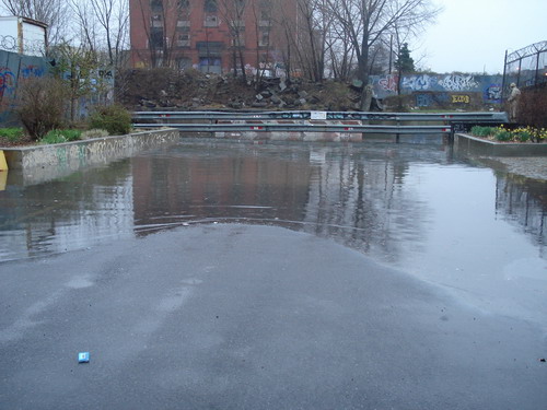
Gowanus Canal did not disappoint yesterday. The pictures here show the Big G about one hour before high tide yesterday evening. The photos show the canal
overflowing its banks at
Second Street (
above)and at
Sackett Street. The other photo shows it within inches of doing the same elsewhere an hour before the high water mark. Also bear in mind that during heavy rains like yesterday's, raw sewage flows directly into the canal, so that what you are looking at is (almost literally)
crap in the streets.
The Second Street photo is particularly noteworthy as it shows flooding at the location of what the
Toll Brothers would like to develop as canal-side housing. The pictures were sent to us by
Friends and Residents of Greater Gowanus (FROGG), which braved the rain and the unsavory water to take these photos. We don't know if the Whole Foods site, which is surrounded on two sides by the Gowanus, was rendered a sea of dirty water or not. The Gowanus Whole Foods will be beneath street level, meaning that, well...use your imagination. (There was additional significant flooding on Ninth Street, but we don't have photos.)
FROGG notes, "City Planning will be meeting with the community this Thu, April 19 to discuss changes in land use around here at the bottom of the Slopes." The meeting for those who are interested will happen at P.S. 32, which is located at 317 Hoyt Street, at 6:00 PM.
(
Gowanus Lounge invites your storm stories and photos. Hit us off with an email or photos at gowanuslounge (at) gmail (dot) com. We will post them with gratitude.)
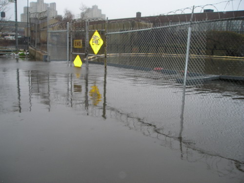
Sackett Street and the Canal
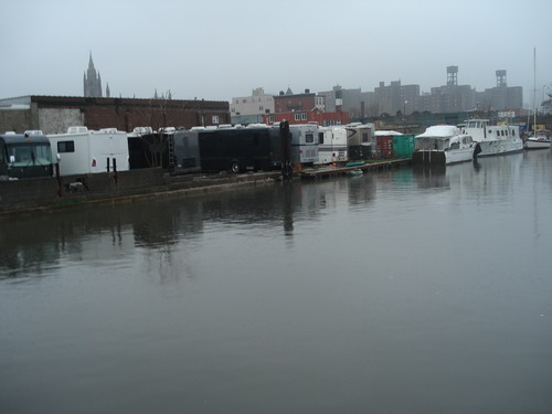
The Canal Between Carroll Street and Union Street Bridges[All photos courtesy of Friends and Residents of Greater Gowanus (FROGG)]Labels: Gowanus Canal, Storms